. OnHiatus.com > Journal 1 > Day Index > Journal Entry: April 22, 1998

Wednesday, April 22, 1998
Dahab (Assalah), Egypt
Egypt's FlagSouthern Sinai's Flag

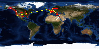
Map
Dahab (Assalah), Egypt:
Latitude: 28° 29' 27" North
Longitude: 34° 31' 29" East
Altitude: 17 feet
From Seattle: 8597 miles
Lodging: Hostel - Auski Camp

Map
Today's Travel:
Country: Egypt
Region: Southern Sinai
Weather: Sunny / Windy

Click on map to Zoom in...
Map
Trip Stats to Date:
Day: 377
Linear Dist: 97707
Countries Visited: 32
Regions Visited: 120
More stats...
Hotels: 79
Friends / Family: 98
Camping: 39
Hostels: 129
Transit: 32
Beers: 1476
Hide...

Journal Entry:
If possible I think it's even windier today than yesterday. Went to the Blue Hole with Rees, Michael and Pip. The conditions were pretty bad due to the wind (Rees had to get out because he was getting sea sick), but the snorkling was still awesome. The Blue Hole is a 110m deep by 50m accross hole in the reef - a very strange formation. It lies about ten kilometers North of Dahab on a very rough costal track. We hired a driver and his Jeep to get us out there. When had to stop to get gas, he noticed me looking at his fuel tank, which was a two liter soft drink bottle sitting next to the driver's seat, and he informed me that the gas tank had fallen off yesterday. Between the state of the car, and the rough road we counted ourselves quite lucky to get there, and even luckier to make it back.

Spent most of the rest of the day huddled behind a wall out of the wind on the beach. As usual, joined the group for happy hour at Nesima. Broke tradition and tried a different restaurant (Al Capone's) for dinner. It was OK, but it took for ever to get the food and the servings weren't big enough. Tomorrow it'll be back to the Shark Club.


Related Sites:
US State Department Consular Information Sheets: Egypt
CIA World Fact Book: Egypt

Paging: [⇚ Apr 21] | [Apr 23 ⇛] OnHiatus.com > Journal 1 > Day Index > Journal Entry: April 22, 1998