-
Tuesday, April 21, 1998
-
Dahab (Assalah), Egypt
|
| Dahab (Assalah), Egypt: | |||||||||||
|
|||||||||||
| Today's Travel: | |||||||
|
|||||||
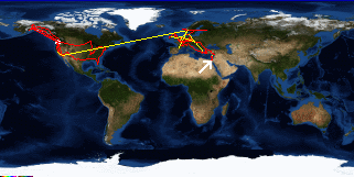
| Trip Stats to Date: | |||||||||||||||||||||||||
|
|||||||||||||||||||||||||
No variety tonight. Went to happy hour at Nesima and dinner at the Shark Club - again.

