. OnHiatus.com > Journal 1 > Day Index > Journal Entry: August 19, 1997

Tuesday, August 19, 1997
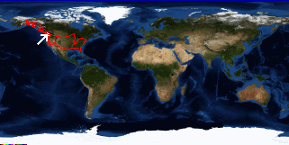
Laguna Beach, California to Seattle, Washington
US's FlagCA's FlagWA's Flag

Map
Seattle, Washington:
Latitude: 47° 40' 24" North
Longitude: 122° 17' 9" West
Altitude: 455 feet
From Seattle: 1 miles
Lodging: Friend / Family - Stacy

Map
Today's Travel:
Country: United States
Regions: California, Washington
Route: SR133, I405, Southwest Flight 495, Southwest Flight 1350, I5
Start: Laguna Beach, California
Stop 1. Oakland Airport, California
Stop 2. Seattle - Tacoma International Airport
End:Seattle, Washington
Linear:1191 miles
Weather: Sunny / Rain / Sunny

Click on map to Zoom in...
Map
Trip Stats to Date:
Day: 131
Linear Dist: 67947
Countries Visited: 2
Regions Visited: 38
More stats...
Hotels: 30
Friends / Family: 55
Camping: 35
Hostels: 7
Transit: 4
Beers: 438
Hide...

Journal Entry:
Beautiful morning in Laguna, replaced my windshield, so my car has mostly recovered from Alaska (still need to wash it...). Delayed plane and pouring rain in Oakland...

Stacy and I watched the moon rise and had a picnic dinner on a pier at Sand Point.


Paging: [⇚ Aug 10] | [Aug 20 ⇛] OnHiatus.com > Journal 1 > Day Index > Journal Entry: August 19, 1997