. OnHiatus.com > Journal 1 > Day Index > Journal Entry: July 29, 1997

Tuesday, July 29, 1997
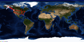
Anchorage to Tok River State Recreation Area, Alaska
US's FlagAK's Flag

Map
Tok River State Recreation Area, Alaska:
Latitude: 63° 19' 39" North
Longitude: 142° 49' 59" West
Altitude: 2612 feet
From Seattle: 1462 miles
Lodging: Camp - Tok River

Map
Today's Travel:
Country: United States
Region: Alaska
Route: SR1 (Glenn Highway), SR2 (Alaska Highway)
Path:Anchorage - Tok River State Recreation Area, Alaska
Road Miles:329 miles
Linear:282 miles
Weather: Sunny / Rain / Sunny

Click on map to Zoom in...
Map
Trip Stats to Date:
Day: 110
Miles Driven:20809
Linear Dist: 63977
Countries Visited: 2
Regions Visited: 38
More stats...
Hotels: 30
Friends / Family: 38
Camping: 31
Hostels: 7
Transit: 4
Beers: 341
Hide...

Journal Entry:
Driving day. Went shopping in Anchorage, changed the Oil, and drove to Tok. Made an early camp since we stayed up late last night talking.


Paging: [⇚ Jul 28] | [Jul 30 ⇛] OnHiatus.com > Journal 1 > Day Index > Journal Entry: July 29, 1997