.
On
Hiatus
.com
>
Journal 1
>
Day Index
>
Journal Entry:
July 11, 1997
Friday, July 11, 1997
Seattle, Washington
Seattle, Washington:
Latitude:
47° 40' 24" North
Longitude:
122° 17' 9" West
Altitude:
1669 feet
From Seattle:
1 miles
Lodging:
Friend / Family - Stacy
Today's Travel:
Country:
United States
Region:
Washington
Route:
I5
Start:
Seattle, Washington
Stop 1.
The Trolleyman Pub, Redhook Ale Brewery, Fremont (Seattle)
Stop 2.
Tim & Amy's (Home!), Seattle
End:
Seattle, Washington
Road Miles:
32 miles
Linear:
8 miles
Weather:
Sunny / Mostly Sunny
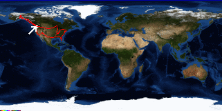
Click on map to Zoom in...
Trip Stats to Date:
Day:
92
Miles Driven:
18822
Linear Dist:
61223
Countries Visited:
2
Regions Visited:
38
More stats...
Hotels:
30
Friends / Family:
28
Camping:
23
Hostels:
7
Transit:
4
Beers:
262
Hide...
Journal Entry:
Had lunch with my parents and sister at Redhook. They're also in town for my cousin Deirdre's wedding. Afterwards I dropped my old house to see Barkley.
Paging: [
⇚ Jul 10
] | [
Jul 12 ⇛
]
On
Hiatus
.com
>
Journal 1
>
Day Index
>
Journal Entry:
July 11, 1997