. OnHiatus.com > Journal 1 > Day Index > Journal Entry: July 3, 1997

Thursday, July 3, 1997
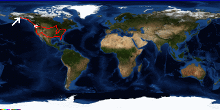
King Mountain State Park to Anchorage, Alaska
US's FlagAK's Flag

Map
Anchorage, Alaska:
Latitude: 61° 11' 40" North
Longitude: 149° 57' 48" West
Altitude: 38 feet
From Seattle: 1529 miles
Lodging: Friend / Family - Erik and Laurie

Map
Today's Travel:
Country: United States
Region: Alaska
Route: SR1 (Glenn Highway)
Path:King Mountain State Park - Anchorage, Alaska
Road Miles:91 miles
Linear:66 miles
Weather: Sunny

Available Photos:

Two perched bald eagles Anchorage, AK

Two perched bald eagles Anchorage, AK

All photo images © 1997-2000 Anthony Jones - Images may not be used without prior written approval.

Click on map to Zoom in...
Map
Trip Stats to Date:
Day: 84
Miles Driven:17550
Linear Dist: 58494
Countries Visited: 2
Regions Visited: 38
More stats...
Hotels: 30
Friends / Family: 25
Camping: 18
Hostels: 7
Transit: 4
Beers: 245
Hide...

Journal Entry:
TBDIt never did get dark last night, at least not while I was awake. Today was pretty slow. I got up late, packed, and got on the road. I stopped a couple miles down the road to do laundry and take a shower. I got to Anchorage early in the afternoon and did some shopping (food, film, etc.). I had a great dinner at Erik and Laurie's house, then Eric took me out and showed me around Anchorage. There are amazing views no matter where you go in Alaska. Now it's after one and it's still light out!!!


Paging: [⇚ Jul 2] | [Jul 4 ⇛] OnHiatus.com > Journal 1 > Day Index > Journal Entry: July 3, 1997