-
Monday, October 4, 1999
-
Key West to Key Largo, Florida

|
| Key Largo, Florida: | |||||||||||
|
|||||||||||
| Today's Travel: | |||||||||||||||
|
|||||||||||||||
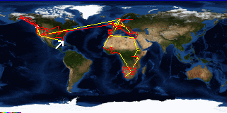
| Trip Stats to Date: | |||||||||||||||||||||||||||
|
|||||||||||||||||||||||||||


