-
Tuesday, January 19, 1999
-
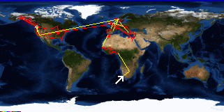
Cape Town, South Africa

|
| Cape Town, South Africa: | |||||||||||
|
|||||||||||
| Today's Travel: | |||||||
|
|||||||
| Trip Stats to Date: | |||||||||||||||||||||||||||
|
|||||||||||||||||||||||||||

