. OnHiatus.com > Journal 1 > Day Index > Journal Entry: January 14, 1999

Thursday, January 14, 1999
Johannesburg, South Africa
South Africa's Flag

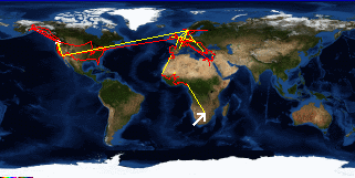
Map
Johannesburg, South Africa:
Latitude: 26° 7' 46" South
Longitude: 28° 1' 48" East
Altitude: 5306 feet
From Seattle: 11663 miles
Lodging: Hostel - The Backpacker's Ritz

Map
Today's Travel:
Country: South Africa
Region: Gauteng
Weather: Sunny

Click on map to Zoom in...
Map
Trip Stats to Date:
Day: 644
Linear Dist: 134925
Countries Visited: 49
Regions Visited: 183
More stats...
Hotels: 197
Friends / Family: 155
Camping: 77
Hostels: 153
Transit: 55
Other Lodging: 6
Beers: 2256
Hide...

Journal Entry:
Dean got out today so we had a nice lunch to celebrate. After lunch I headed back to Sandton City Mall to get some more film developed (the test roll from my new camera, the test roll from my old camera, and another old roll). Hopefully I'll be able to determine if all my film is trashed. While I was there I found another one hour lab and decided to have a few more rolls developed as a control against the first lab (in case it was the lab that ruined my film). All eight rolls came back - no problem. So either the first roll was bad to start with or the lab screwed it up. Either way a huge relief.

Back at the hostel met up with about a dozen others and we went to the pub for diner, beers, and pool.


Related Sites:
CNN: Current Weather in Johannesburg
US State Department Consular Information Sheets: South Africa
CIA World Fact Book: South Africa

Paging: [⇚ Jan 13] | [Jan 15 ⇛] OnHiatus.com > Journal 1 > Day Index > Journal Entry: January 14, 1999