. OnHiatus.com > Journal 1 > Day Index > Journal Entry: October 5, 1997

Sunday, October 5, 1997
Simi, Nisos Symi to Palon, Nisos Nisiros, Greece
Greece's FlagDodecanese Islands's Flag

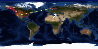
Map
Palon, Nisos Nisiros, Greece:
Latitude: 36° 37' 10" North
Longitude: 27° 10' 16" East
From Seattle: 7648 miles
Lodging: Transit - The Andreas

Map
Today's Travel:
Country: Greece
Region: Dodecanese Islands
Route: The Andreas
Path:Simi, Nisos Symi - Palon, Nisos Nisiros, Greece
Linear:37 miles
Weather: Sunny

Available Photos:

Looking up at a church through an alley Nisos Symi, Greece

Kitten naping in the sun Nisos Symi, Greece

Symi Nisos Symi, Greece

All photo images © 1997-2000 Anthony Jones - Images may not be used without prior written approval.

Click on map to Zoom in...
Map
Trip Stats to Date:
Day: 178
Linear Dist: 36282
Countries Visited: 9
Regions Visited: 48
More stats...
Hotels: 32
Friends / Family: 77
Camping: 35
Hostels: 24
Transit: 10
Beers: 632
Hide...

Journal Entry:
Spent the morning walking around Symi. Beautiful, everything a Greek island should be.

Set sail at about 11am. Got some good wind and sailed! For about 10 minutes. We then spent the rest of the day fighting dead into the wind. Rough, bumpy, in general a blah day. Got into Palon's harbor at about 6:30.

Palon is small and desolate, not nearly as cute as Symi, but still quaint. Had a nice grilled lamb dinner.


Paging: [⇚ Oct 4] | [Oct 6 ⇛] OnHiatus.com > Journal 1 > Day Index > Journal Entry: October 5, 1997