. OnHiatus.com > Journal 1 > Day Index > Journal Entry: September 8, 1997

Monday, September 8, 1997
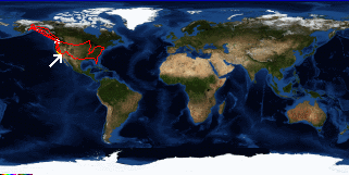
Laguna Beach to Los Angeles, California
US's FlagCA's Flag

Map
Los Angeles, California:
Latitude: 34° 10' 0" North
Longitude: 118° 20' 0" West
Altitude: 455 feet
From Seattle: 1079 miles
Lodging: Transit - Air France Flight 061

Map
Today's Travel:
Country: United States
Region: California
Route: I5, Air France - Flight 61
Path:Laguna Beach - Los Angeles, California
Linear:58 miles
Weather: Sunny

Available Photos:

Me at the enterance to the international gates LAX, CA

Me at the enterance to the international gates LAX, CA

All photo images © 1997-2000 Anthony Jones - Images may not be used without prior written approval.

Click on map to Zoom in...
Map
Trip Stats to Date:
Day: 151
Linear Dist: 69978
Countries Visited: 2
Regions Visited: 38
More stats...
Hotels: 30
Friends / Family: 74
Camping: 35
Hostels: 7
Transit: 5
Beers: 515
Hide...

Journal Entry:
A frantic day trying to get all the last minute details taken care of, trying to teach my mom to use a computer, and helping my dad haul lumber.

The whole family gathered to take me to the airport (we missed the exit on the freeway twice).

Good (uneventful) flight so far...


Paging: [⇚ Sep 5] | [Sep 9 ⇛] OnHiatus.com > Journal 1 > Day Index > Journal Entry: September 8, 1997